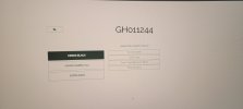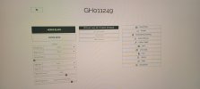

Hey guys, so I used my Karma drone to shoot some green screen footage to put into blender and I'm looking to recreate the movement in Blender using the GPS data. I'm using Telemetry Extractor to get the data in the right format but as the photos show, when I upload the Karma footage there's no option for GPS data. (GH011244 is the drone clip and GH011249 is the camera only footsge) But when I upload a shot just from the GoPro it gives an option for GPS data then. Why would Karma footage not contain GPS data?
Also attached is the data extracted from the drone itself. Any ideas on which data could be used to recreate a flight path?
Also attached is the data extracted from the drone itself. Any ideas on which data could be used to recreate a flight path?